 Grand Canyon Backpacking, 2001
Along the Tonto Trail, from South Bass to Boucher
 In mid-March, 2001, Doug Minderlen, Greg Reinhart and myself (Dave Wyant) embarked on a 4-day trek through the west-central area of the Grand Canyon. Our route descended into the Canyon on the South Bass trail, followed the Tonto trail to Boucher Creek, and climbed out on the Boucher Trail. The entire trip encompassed approximately 42 miles and took us along 29 miles of the Tonto trail which we had not previously visited.
Click on any image to enlarge.
March, 2001
Our trip began with a paid shuttle from Grand Canyon Village to the South Bass trailhead, which is 28 miles distant on a secondary road that was possibly impassible in places. Our driver, Tim, was almost an hour late and coupled with an already late start, meant that we would likely not reach our goal of the Tonto Platform by nightfall. The road to the trailhead was wet and muddy due to recent snowmelt. In fact, one extremely difficult section along the road prevented our driver from taking us all the way in. We were forced to walk the last 3 miles along the lonely, muddy road. By the time we reached the trailhead and started down into the Canyon, we had less than 1 hour before sunset.
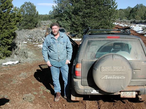 Tim, our shuttle driver |
 The walk to the trailhead |
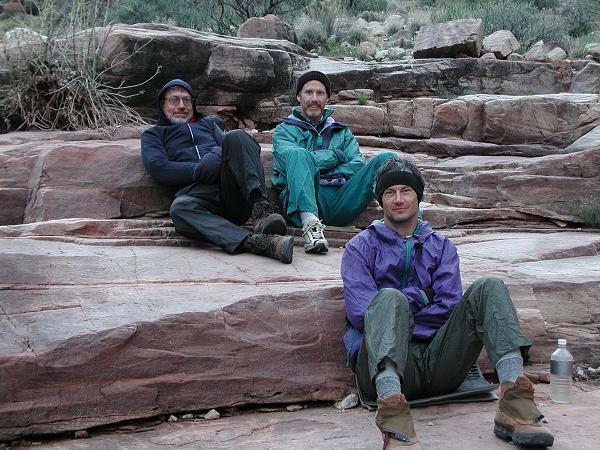
There was little remaining evidence of the 12" snowfall that had occured only 4 days earlier, most of it having melted in the warm, northern Arizona sun. Nevertheless, a nip in the air and some snow on the trail along the north-facing slopes reminded us that spring comes late to the 7000' elevation of the South Rim. After carefully picking our way through the remaining patches of snow over the course of the first 1/4 mile, the trail cleared and the walking became easier. Although snow-covered, the upper portion of the trail was never icy and did not require the use of our instep crampons, which we all had with us. By 7:00pm, we had descended to and crossed the Darwin Plateau and were facing a long, rocky descent in waning light. Better judgement overcame us and we opted to spend the night on the 5200' plateau and continue our descent in the morning. Our first night out saw us only a couple of miles from the trailhead in a cold location, low on water, but happy to be back in the Canyon.
 A late start on the snowy South Bass trail |
 First night's campsite on the Darwin Plateau |
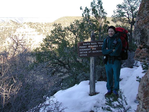
We awoke to a chilly, 20 degree morning with frost on the inside and outside of our tents, but within minutes we had early, warming sunshine at our campsite on the open plateau. After a quick, dry breakfast, we continued our descent into the depths of the Canyon, winding around to the head of Bass Canyon and descending through its center. Within 2 hours, we arrived at the junction with the Tonto Trail and elected to skip our planned 5-mile (round-trip) side trip to Bass Rapids on the Colorado River, due to our late start and insufficient progress from the day before. We decided instead to head east across the Tonto in the hopes of making up our lost ground and getting back on schedule. Our next planned campsite was at Turquoise Canyon, still 14 miles away.
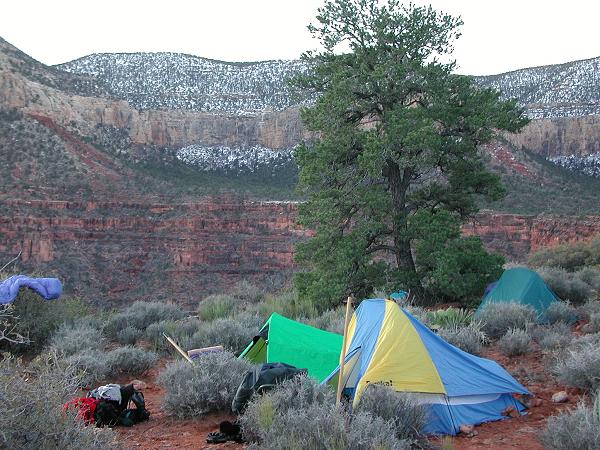
In another 1-1/2 hours, we arrived at Serpentine Canyon, our first side canyon along the Tonto and our first good water source. We joyfully tanked up on water and relaxed in the warm sunshine. Not knowing what the water situation would be ahead, we filtered and each carried extra, just in case water became hard to find. During the remainder of the day, we trudged across the Tonto, soaking in the sights and enjoying the perfect weather. Thanks to the recent, abundant spring precipitation, each major side canyon that we encountered contained a flowing stream. The flow in each canyon varied from a small stream to a trickle and was always fresh and clear. By the time we arrived at our destination of Turquoise Canyon, we were tired, footweary and glad to stop. We pitched tents, filtered water, and enjoyed a relaxing evening.
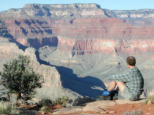
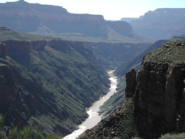 The Colorado River, as seen from the Tonto trail |
 Pleasant walking along the Tonto |
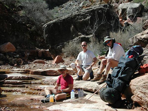 Filtering water at Serpentine Canyon |
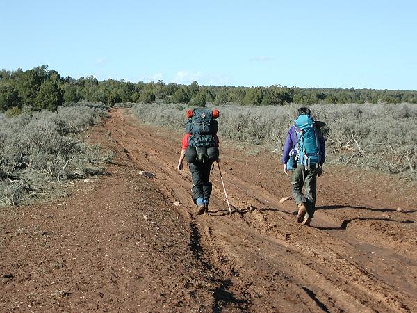
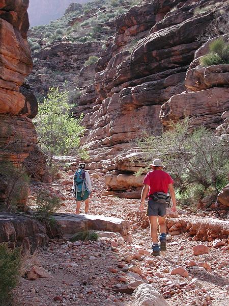
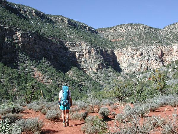
Up at sunrise again, we were greeted with warmer temperatures (35 deg.) at our lower elevation. We packed up and continued our trek along the Tonto. Our destination for this 3rd day was the significant gorge of Slate Canyon, 9+ miles distant. We encountered more sunny skies and warm temperatures (upper-60's) on our journey across the Tonto. The entire section of the Tonto Trail from Bass Canyon to Boucher Creek is fairly indistinct in places and sometimes requires a careful eye to follow. The infrequent rock cairn reinforces a guess here and there as to the course of the trail. But such is the price of the solitude on the trail less-travelled. We encountered no other hikers along this entire 29-mile stretch of the Tonto Trail.
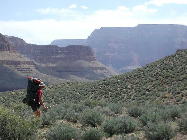 Strolling along the Tonto trail |
 Checking our route |
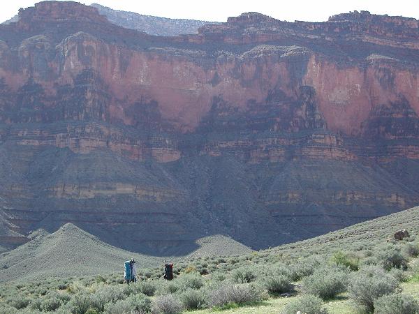 Massive views |
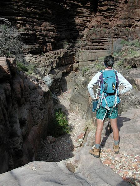
We arrived at Slate Canyon relatively early, having only 9 miles of trail walking to cover. Our intent was to make camp early in the day and then explore Slate Canyon down to the Colorado River. At 2:30pm, Doug and I entered Slate and began to follow its meandering route toward the Colorado. We knew that the route was passable based upon a trip report posted by other hikers on the internet, however, in a half hour we encountered an obstacle that we chose not to pass. A 15' dropoff contained a pool of water at the bottom. While it would have been quite easy to scramble down the dropoff and jump to dry land, the climb back up would have required us to wade the pool and scramble up the steep rock with wet feet. Although we could have gotten past this obstacle, it wasn't important enough to either of us to submerse our boots in the pool on the return trip. We decided instead to backtrack to camp and enjoy a restful evening.
|
|
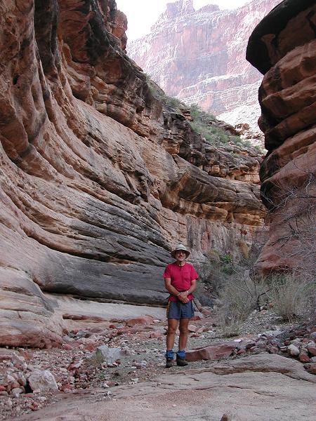
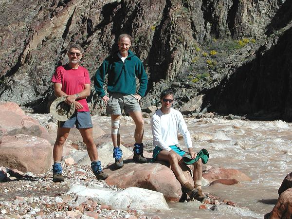
The next day dawned again with more clear skies and sunshine, which was very welcome after seeing fast-moving and threatening clouds move in the previous evening. Good weather is normal and common in the Southwest, but it is not guaranteed. We were thankful to awake to another cloudless day. Once again, we packed up and began what would be our last section of the Tonto Trail, a 5+ mile section from Slate Canyon to Boucher Creek. We arrived at Boucher before 11:00am and encountered our first, fellow travellers since the Darwin Plateau, 2 days earlier. This was a group of 5 who were doing the same trip as us, but had been a day or two ahead of us. They too had received a ride from a paid shuttle to the South Bass trailhead, but had been fortunate enough to be taken all the way in by a different driver (Dennis) with a more capable 4WD vehicle.
We dropped our packs and walked the short side-trip along Boucher Creek down to the Colorado River. The Colorado was flowing fast, noisy, and chocolate brown at Boucher Rapids. On the beach, we met and talked with a threesome who were half-way through an epic 6-week trip in the Canyon. Their route began at Havasupai, traversed around the Great Thumb, and would continue along the Tonto all the way to the Little Colorado River. From there, they would cross to the north side and climb out on the Nankoweap Trail. Essentially, they were recreating Colin Fletcher's trip as defined in his book,
 More walking along the Tonto |
 The muddy Colorado at Boucher Rapids |
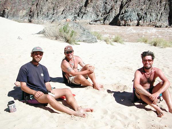 Three guys halfway thru a 6 week trip |
Still early in the day, we loaded up our packs with extra water and began the climb up the Boucher Trail to the rim. Our intent was to climb part way out and make a high, dry camp at Yuma Point, which is roughly half the trail distance and 2/3 the elevation gain to the rim. Starting at this hour, we had no hope of climbing all the way to the rim in time to catch the free shuttle from Hermits Rest (our exit point) back to the Village. The shuttle would not be running at the late hour that we would exit if climbing all the way out. Nonetheless, by starting out this afternoon we would be ensured of an early exit the following day.
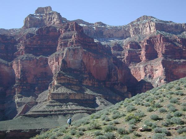
The Boucher Trail is brutal in its steepness. It climbs sharply out of Boucher Creek to a plateau near the landmark of White Butte. Doug, our strongest climber, led the way and maintained a consistent, steady pace that got us up to the plateau in just a couple of hours. After a short rest, we traversed around to the head of Travertine Canyon and endured a tiring, even steeper climb up to the small high plateau at Yuma Point. Our reward for this effort was a stellar campsite with stupendous views into the vast-sprawling Canyon, magnificent in the evening light. As dusk fell and the temperatures dropped, we huddled around the warmth of our campstove and feasted upon extra Pop Tarts that Doug had brought along.
 Climbing out on the Boucher Trail |
 Rest period on the plateau near White Butte |
 The Boucher Trail provides stupendous views |
 Scenic campsite at Yuma Point |
 Enjoying the view |
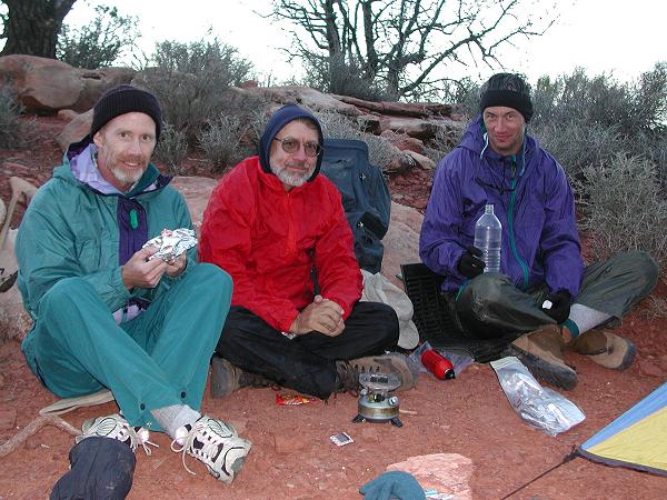 Pop Tarts and gab around a warm camp stove |
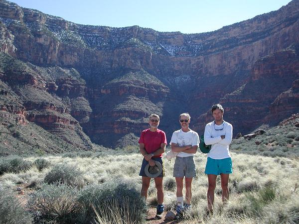
Our last day dawned clear again with early morning sun, thanks to the location of our high, exposed campsite. We packed up one final time and hit the trail. In a few hours, we joined the Hermit Trail and encountered numerous other hikers on this more used trail. After a last rest period, we tackled the remaining hour-long climb to the rim and exited the Canyon before noon.
 Approaching higher altitude on the upper Boucher Trail |
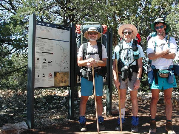 Exit at Hermit's Rest |