 |
Hermit to Bright Angel, 2005 |
 |
The Hermit to Bright Angel loop is a popular hike in the Grand Canyon and is a common next step for hikers
wanting to stray out of the corridor zone trails (Bright Angel, South Kaibab, North Kaibab). The entire loop is
approximately 23.5 miles in length, but can be a few miles longer if side trips to Granite Rapids or Plateau Point
are taken. Our trip, with a visit to Granite Rapids, would be close to 27 miles. Many people do this loop as
a 3 day backpacking trip, although it can be done in more or fewer days. My only other visit to this part of
the Tonto Trail was in 1992, when I walked from Hermit to Bright Angel with a side trip to Plateau Point.
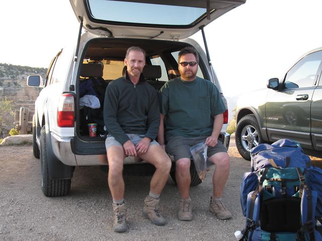
On this trip, Joe Breckel and I (Dave Wyant) would do the same Hermit to Bright Angel loop, but would throw in the side trip down Monument Creek to Granite Rapids, which I had not done before. This would be Joe's first Grand Canyon hike and getting all the way down to the Colorado River at the bottom of the Canyon would be a bonus.
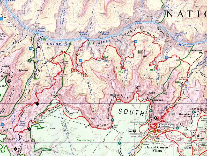
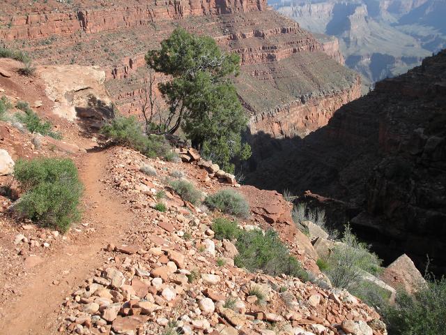
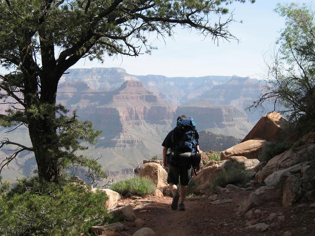
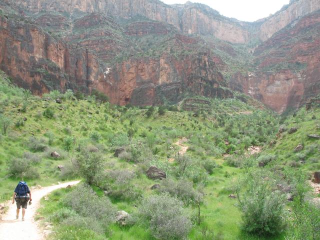
Our hike began at 7:40am on a bright, sunny, Friday morning. After leaving our car at Bright Angel Trailhead and taking the West Rim shuttle bus to Hermits Rest, we walked the few hundred yards to the Hermit Trailhead and started down the trail. Within an hour, we had descended the initial steep grades and flattened out on a small plateau near the head of Hermit Canyon's inner gorge. Over next few miles, we would follow the Hermit trail over relatively level ground along the eastern lip of this inner gorge. Within another 20 minutes, we arrived at Santa Maria Spring and stopped for a short break.
 Upper Hermit Trail |
 Hermit Canyon |
 Santa Maria Spring |
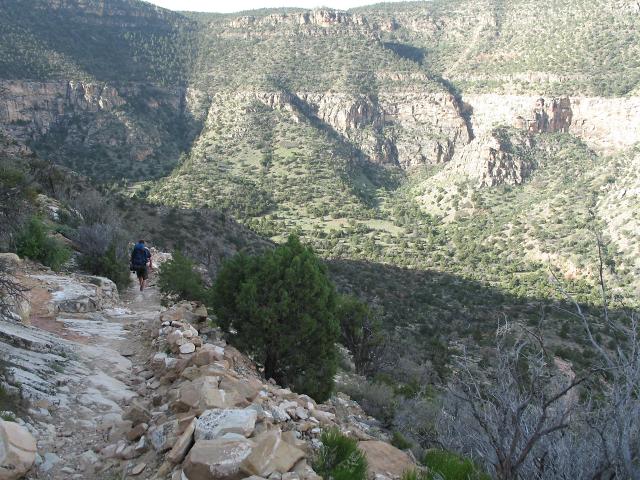
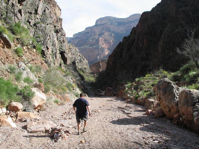
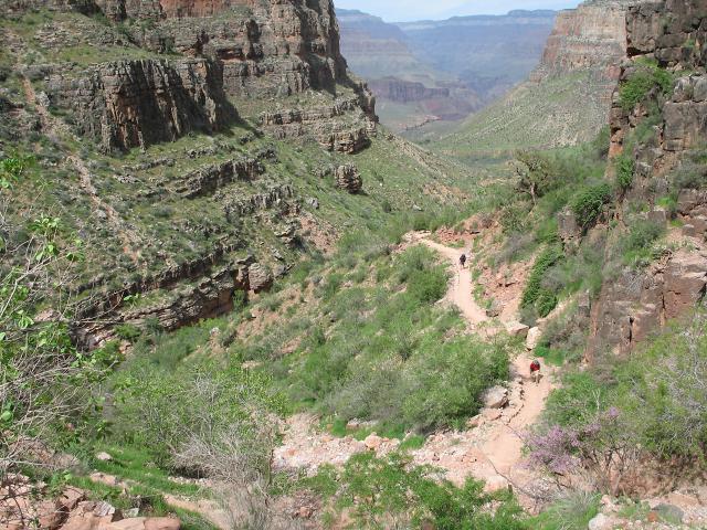
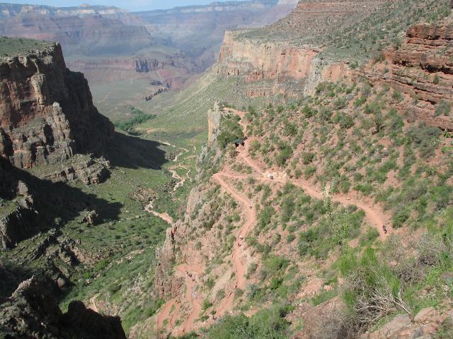
It was a beautiful, sunny day and the air had warmed to a very pleasant level since leaving the rim. After our short break, we continued along the lip of Hermit Canyon's inner gorge for another hour or more until our trail arrived at the top of the Cathedral Stairs, a significant descent (or ascent if coming the other way) down to the Tonto Platform. We took another break and started down. At noon, we bottomed out on our descent and arrived on the Tonto Platform at the junction with the Tonto Trail. From here, we left the Hermit Trail and turned east, now following the Tonto Trail. We would follow this section of the Tonto for approximately 12 miles to Indian Garden, not counting a side trip down Monument Creek to the river.
 Hermit |
�
 Canyon |
 Views |
 Top of Cathedral Stairs |
 Approaching the Tonto |
 Tonto Trail Jct. |
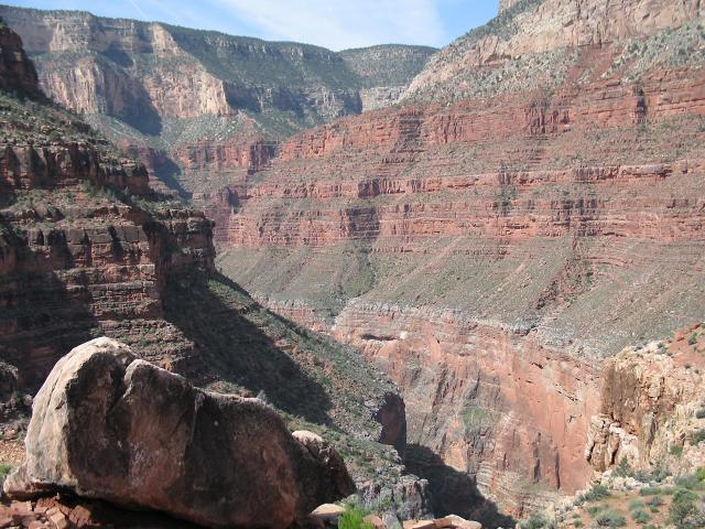
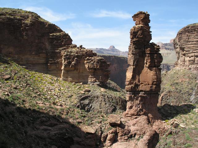
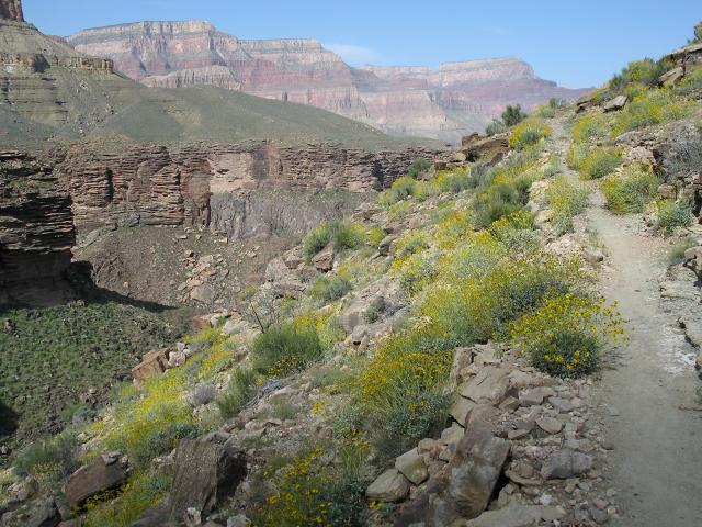
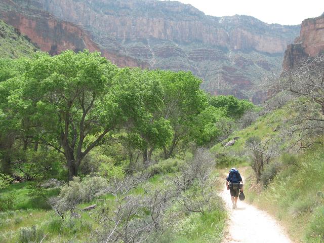
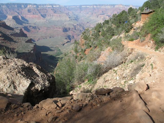
The Tonto Trail snakes along the top of the Tonto Platform, paralleling the Colorado River for approximately 95 trail miles. It generally maintains a semi-constant elevation, but swings wide around prominent ridges extending out from the South Rim and then cuts deeply toward the rim as it traverses into side canyons. Although the Tonto Platform is a relatively consistent elevation, the trail itself seems constantly rolling, always making minor elevation changes. There are few big climbs on the Tonto Trail, but there is also a notable absence of level walking. Due to many spring rains in Arizona this year, the Tonto was populated with a nice selection of wildflowers. Most notable was a flower that closely resembled a Mexican gold poppy, but was lavender in color. I later learned that this was a Mariposa Lilly, but it sure looked like a poppy.
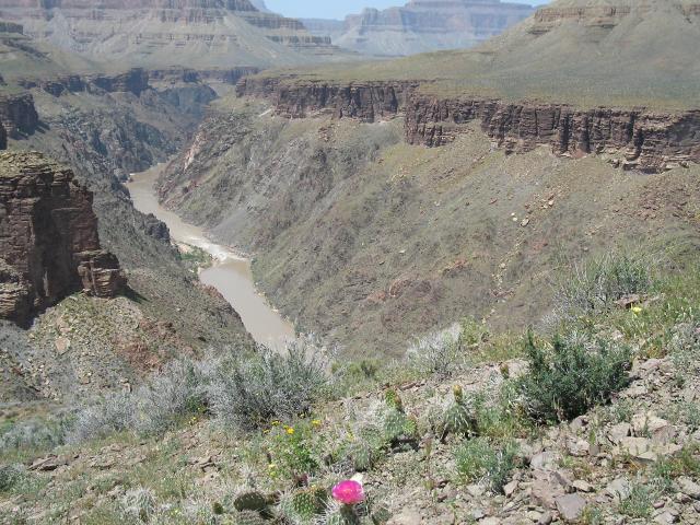
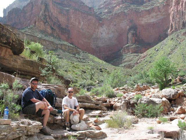
Within an hour, we had rounded Cope Butte and had arrived at Monument Creek. Not necessarily wanting to haul our backpacks down the side trip to the river, we transferred most of our equipment to one pack, found a tree and hung the pack to prevent intrusion by rodents. We added the bare essentials (first aid, water, camera) to the second pack and headed down Monument Creek for the river. Although our map indicated 1.9 miles each way to the river, it seemed shorter and we arrived at there after less than 40 minutes of leisurely walking.
 Along the Tonto Trail |
 Mariposa Lilly |
 Approaching Monument |
 Monument Creek |
 The Monument |
 To the River |
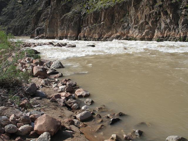
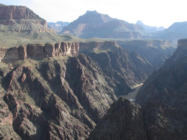
The river is sometimes green and sometimes brown, depending on factors such as dam release rates, recent rainfall, and runoff sediment. Today it was brown. Not having a lot of remaining time left in the day, we stayed at the river for less than an hour. This provided plenty of time to jump in and splash around in order to cool off on this moderately warm, 90 degree day. As expected, the river was very cold, but felt oh so refreshing.
 Colorado River |
 Granite Rapidst |
 Back up Monument |
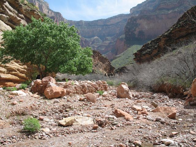
We left the river and walked another 40 minutes back up Monument to our pack, hanging from the tree. We now had only another 1.3 miles of walking ahead of us for this day, to our campsite at Cedar Spring. Since our camp was expected to be a dry one, we filtered water from Monument Creek and topped up all of our available water storage containers. Whatever we could carry would have to last us for the remainder of the day, provide water for camp, and get us through the next day until we arrived at Indian Garden. Our total capacity was about 6 liters each and this proved to be plenty. It added nearly 10 pounds to each of our packs, but we would only have to carry it to our nearby campsite.
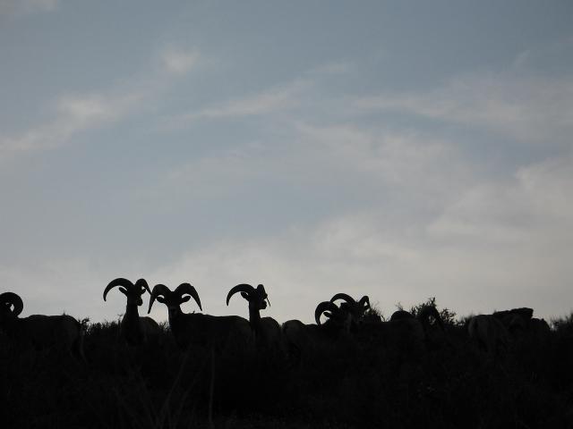
We left Monument and continued along the Tonto Trail toward Cedar Spring. Although only 1.3 miles distant, this section of the Tonto seemed twice as long and took us a full hour to negotiate... probably a testament to our tiredness at the end of a long day. Along the way, we passed a small herd of 8 bighorn sheep grazing not far from the trail. They watched warily as we passed, but did not run even though the trail took us to within 50 yards of them. Finally we arrived at Cedar Spring with only 45 minutes of daylight remaining. After setting up camp and cooking, we soon headed for bed. It had been a long day
 On to Cedar Spring |
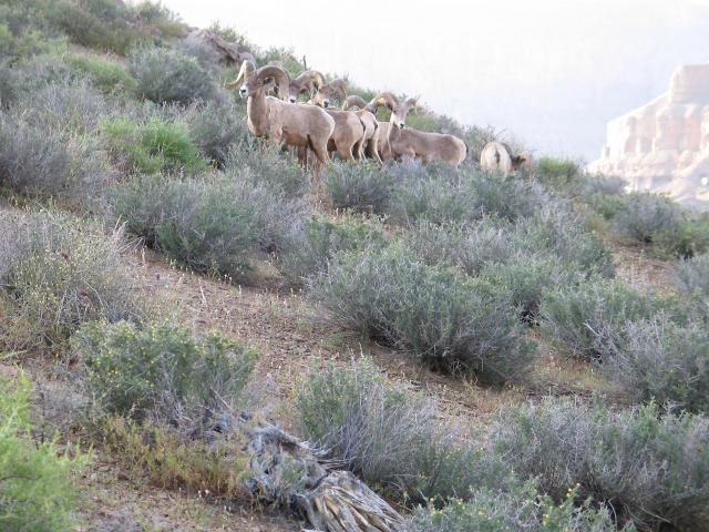 Bighorn Sheep |
 |
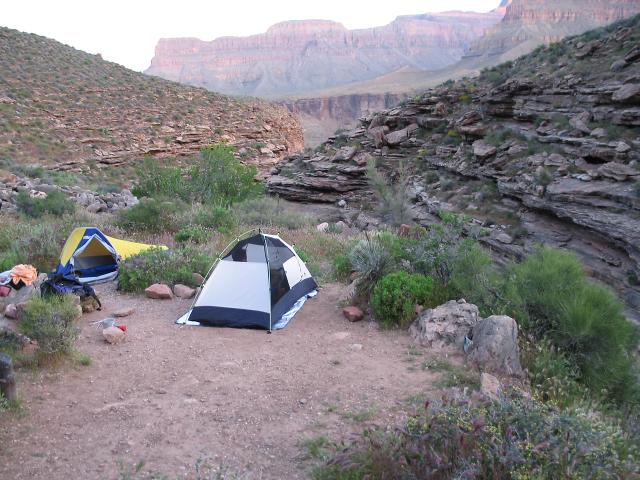 Campsite |
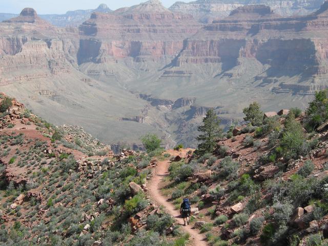
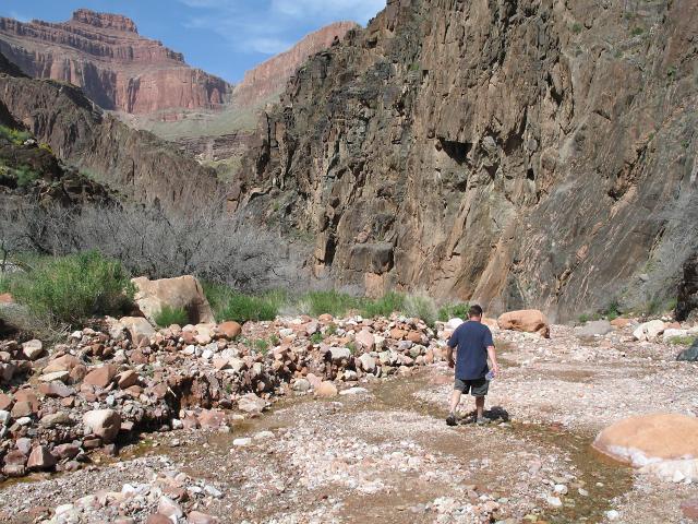
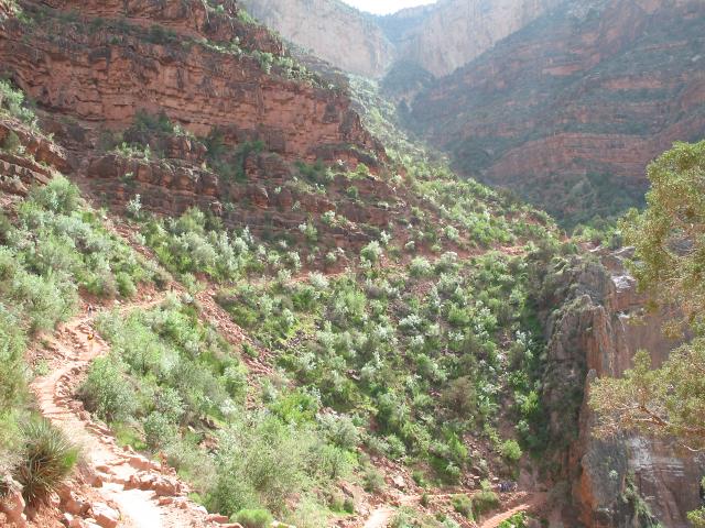
The next morning, we "slept in" until 6am, then got up, ate, packed and hit the trail again. The 10 hours of sack time provided us with the rest we needed to get up and face another long day. We were feeling good and ready to go again. We still had 9.4 miles of steady Tonto walking ahead of us before reaching Indian Garden and a water resupply. Fortunately, we still had plenty of water left from the previous day and were in no danger of running out. Although the day was expected to be a warm one, it would not be blistering hot and water consumption should be normal.
 Brittlebush |
 Approaching Salt Canyon |
 Granite Gorge |
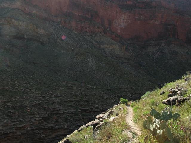
An hour of walking brought us to Salt Creek. Water was flowing in this side canyon, but we did not need any and did not collect any. The water in Salt was rumored to be of poor quality, so we had not planned on replenishing there. We took a short break and then continued onward. Our next side Canyon was Horn, and being over 4 miles from Salt, it took us a little time to get there. The water was also flowing in Horn, but it was said to contain traces of radioactivity, so we did not collect any there either.
 Approaching Horn Canyon |
 Tonto Wildflowers |
 Horn Canyon |
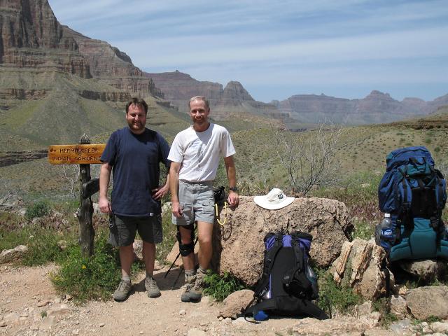
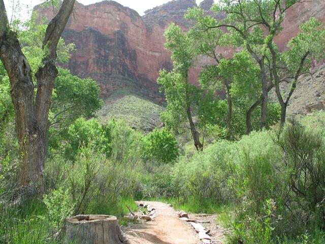
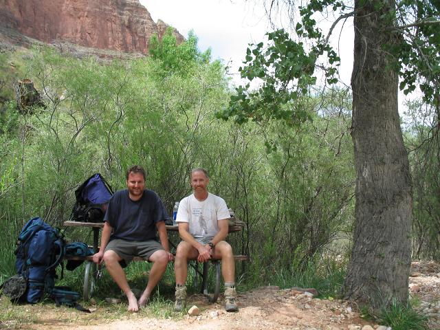
Indian Garden was only another 2.9 miles away. We strolled onward along the Tonto and soon found ourselves in the cool shade of the abundant, large cottonwood trees that reside at the oasis of Indian Garden. After having seen no one else on the trail so far that day, we were a bit overwhelmed by the crowds hanging around the benches near the water supply. We chose an out-of-the-way picnic table for our rest stop and hung out there for nearly an hour.
 Near Indian Garden |
 Indian Garden |
 Our picnic table |
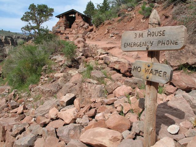
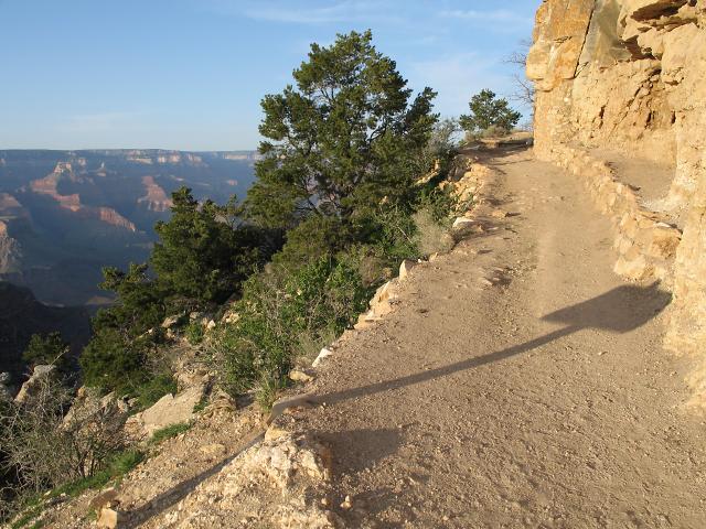
All that remained was the 4.6 mile climb up the Bright Angel Trail to the South Rim. Like any trail that climbs to the rim in the Canyon, there is naturally a bit of effort involved. We started up at 2:15pm, taking our time and pacing ourselves. In an hour, we arrived at 3 Mile Resthouse, which is the first major landmark along the way. Being not yet summer, the water was turned off at the resthouses today and we were required to carry all that we would need to get from Indian Garden to the rim. We took a few minutes and relaxed in the shade of the stone house.
 Leaving Indian Garden |
 Starting the big climb |
 3 Mile Resthouse |
Another push brought us to 1-1/2 Mile Resthouse and another rest stop. We stayed and rested for a few minutes before trudging on up the last remaining section of the trail to the rim, arriving there without any significant problem by 6:45pm. Even though it was hard work climbing the 3100' to the rim, Joe summarized it nicely when he said "I'm almost sorry its over". There indeed is a certain satisfaction and personal reward both during and after climbing out of the Grand Canyon and arriving at the rim.
 Leaving 3 Mi Resthouse |
 A look back |
 Near 1-1/2 Mi Resthouse |
 Almost out |
 Finished |