 |
South Bass to the Huxley Terrace, 2004 |
 |
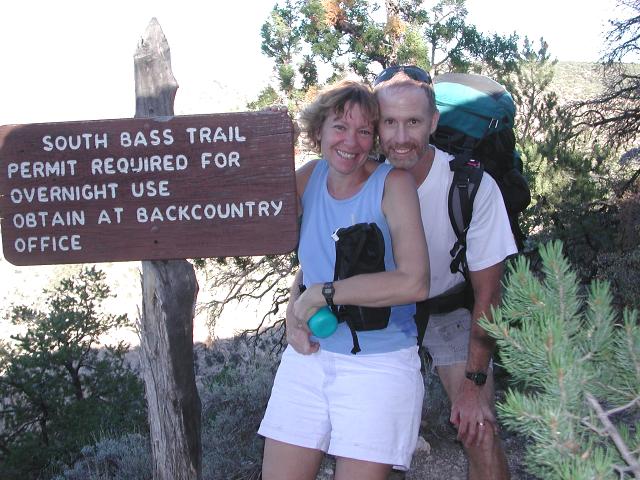
Located approximately 20 miles west of Grand Canyon Village, the South Bass Trail is the western most of the Grand Canyon's 8 major South Rim trails. This trail was built in the late 1800's by William Wallace Bass, who moved to the Canyon for health reasons. Although Bass was given only a few years to live by his midwestern doctors, he thrived at the Grand Canyon and outlasted his doctor's life expectancy predictions by over a half century. Bass developed a tourist camp on the South Rim and established mining operations and a winter camp on the north side of the Colorado River. His South Rim to North Rim trail system was created by improving footpaths used by prehistoric Indians.
In October, 2004, we chose to explore the upper portion of the South Bass Trail, down to an overlook on the Huxley Terrace. After driving 29 miles on a dirt road, we arrived at the trailhead and were surprised to find 6 other vehicles there. Due to the remoteness of the trailhead and being a weekday, we expected to find no one else there, as had been the case on 2 other visits. We started down the trail on a beautiful, sunny day.
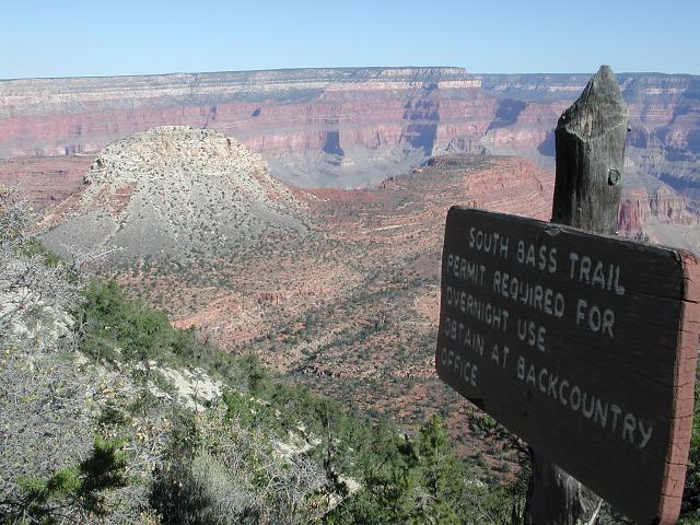 South Bass trailhead |
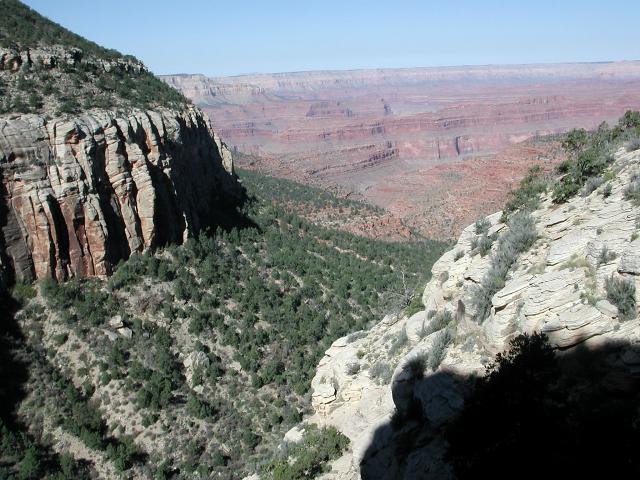 Upper trail |
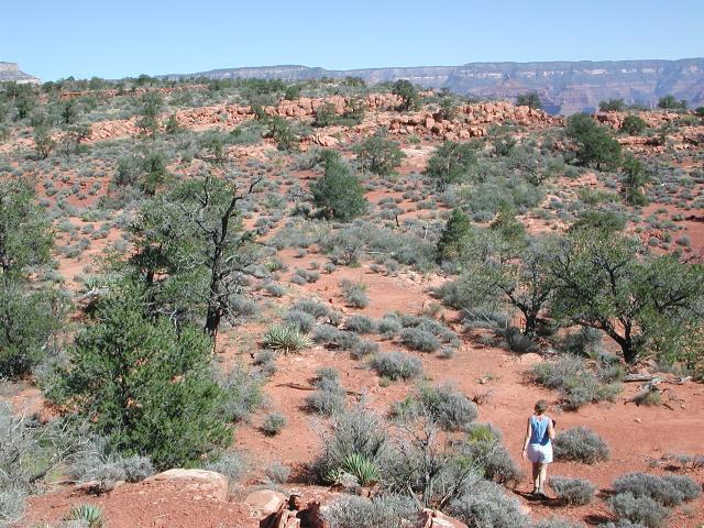
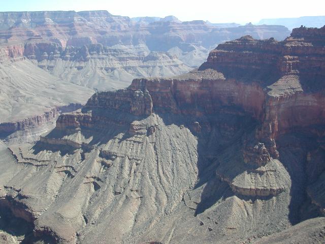
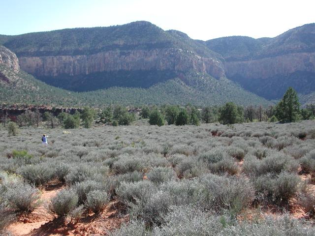
 Approaching the plateau |
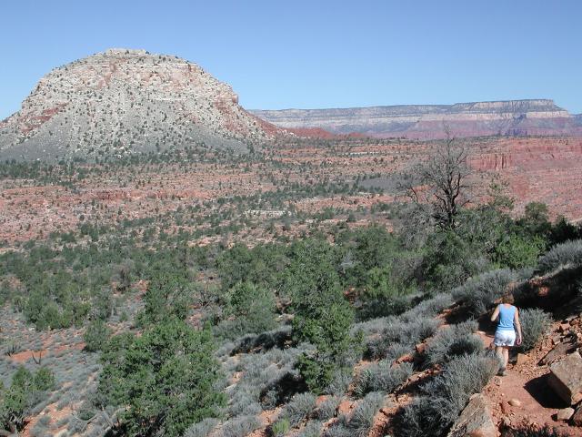
The Bass Trail is in good shape and we quickly descended 1000' to the esplanade and strolled across the Darwin Plateau towards our destination of Huxley Terrace. The ever-present hulk of Mt. Heuwathali loomed constantly in view. We stayed on the trail until it took a dive off the plateau down into Bass Canyon, then left the trail for a short scramble up and onto the Huxley Terrace. From the Huxley Terrace, it became obvious that Mt. Huethawali is actually more fin-like than the roundish mound it appeared to be from the rim.
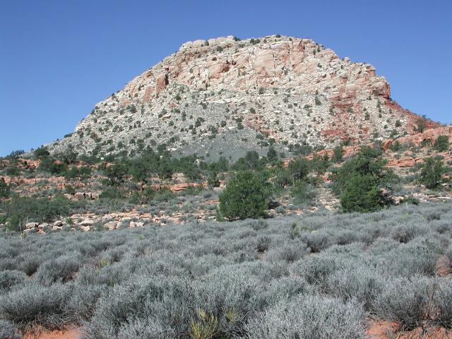 Mt. Heuthawali |
 Climb to Huxley |
 On Huxley Terrace |
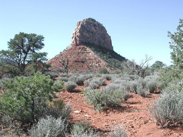 Fin-like Heuthawali |
 Approaching the edge |
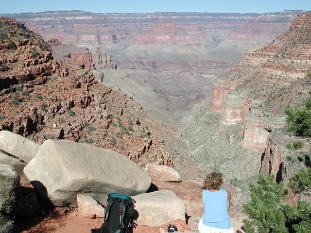
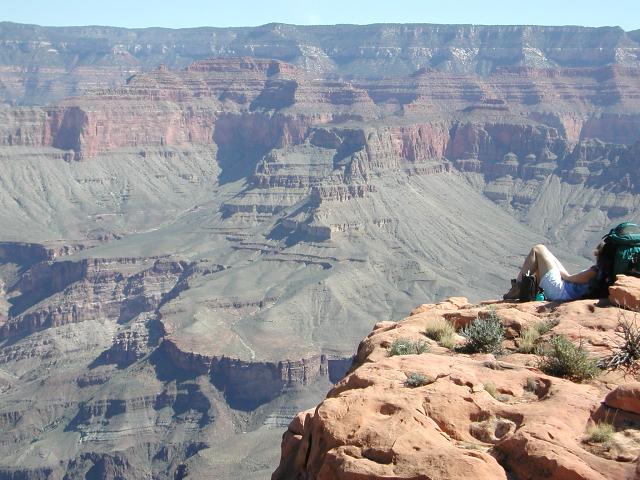 Cindy on the edge |
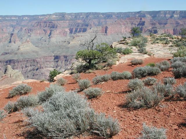
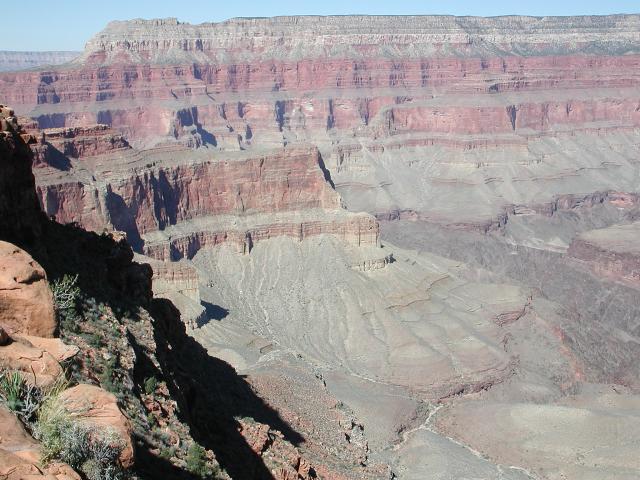
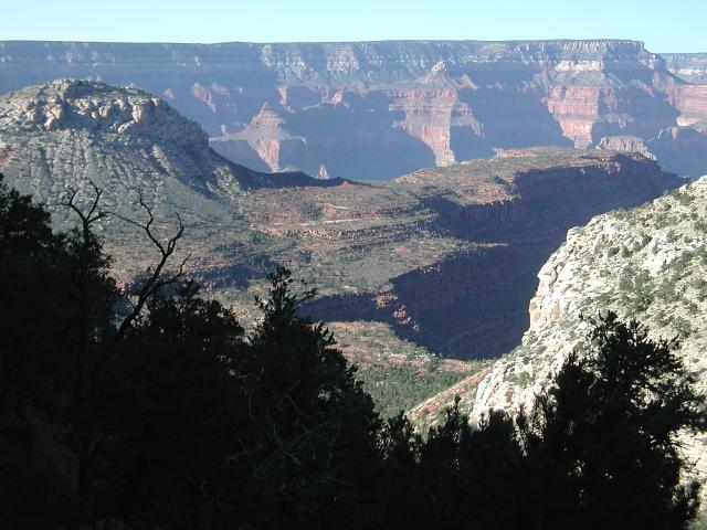
Once on the terrace, we followed gentle terrain out to its northern edge for a good view of the inner Canyon. We stayed for 1-1/2 hours enjoying the fine view and the warm October sun. The Huxley Terrace is the middle of 3 "fingers" that jut northward out from the plateau. Although the views were indeed good on Huxley, they were blocked somewhat up-canyon and down-canyon by the neighboring fingers of the Spencer Terrace and the Grand Scenic Divide. The view to the river was also blocked by the significant Wallace Butte. We made a mental note to come back again some day and walk out the edge of the Grand Scenic Divide. With a name like that, the views from that terrace would surely be good.
 View east |
 View west |
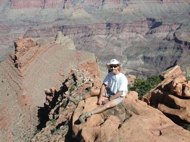 Dave on the edge |
 Huxley Terrace panorama |
After soaking in the magnificent day, we turned around and went back the way we had come. Back across the Huxley Terrace, down to the Darwin Plateau, back through a field of scrub to the head of Bass Canyon. We paused there to enjoy yet more fine views before beginning the climb back to the rim.
 Time to head back |
 Back on the plateau |
 Head of Bass Canyon |
Halfway up the climb, we met two other hikers who were the first other people that we had seen on the trail. These were two young PSAR (Preliminary Search and Rescue) rangers, just starting a multi-day journey down the South Bass. Their plan was to descend to the Colorado River, catch a pre-arranged boat ride downstream to Thunder River, and then climb out the Thunder River trail. A fine itinerary indeed!
 Climbing out |
 Almost to the rim |
 Back at the trailhead |
The climb from the plateau to the rim is not overly long by Grand Canyon standards, perhaps 1300' over 1.7 miles. We arrived back at the trailhead in short time, and sat to enjoy the splendid evening light in the Canyon. It was an enjoyable trip and we vowed to come back again to explore other areas of the upper South Bass Trail.