 |
Red Tanks Loop, 2003 |
Click on any image to enlarge.
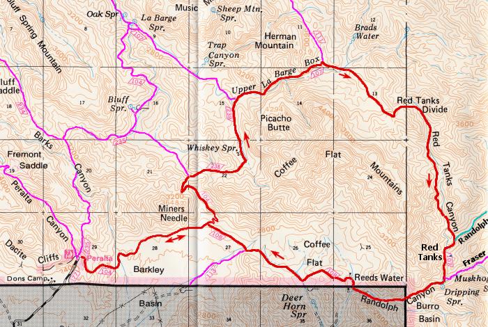
On January 31, 2003, I spent the day walking in the Superstition Wilderness east of Phoenix. My chosen hike was a 21 mile loop starting from the Peralta Trailhead and basically encircling large Coffee Flat Mountain about 5 miles to the east. My route would take me east through Barkley Basin, up the long, gentle climb to Miners Summit, down the Whiskey Springs Trail into LaBarge Canyon, and through Upper LaBarge Box. From there, I would pick up the Red Tanks Trail and follow it over Red Tanks Divide to Randolph Canyon and the red tanks, a favorite location in the "Supes". An easy, but lengthy 7+ mile stroll would then return me to my starting point at the Peralta Trailhead. I had done this loop a couple of times in the past, but that had been about 8 years previous. Warm weather had been beckoning lately and this day felt like the right time to reacquaint myself with this remote area of the Superstitions.
I left home at 6:00am and within 75 minutes found myself at the pay station for parking at Peralta Trailhead. The pay station is fairly new, having been in place for about 5 years as part of the government's Fee Demo program. Visitors didn't used to have to pay, but now a mandatory $4 per day, per car is required. At 7:30am, I was on the Dutchman Trail and strolling for Barkley Basin. The sun had been up for only about 10 minutes and the morning felt fresh and alive. The expected high temperature for nearby Phoenix was 83 degrees and already it felt warmish at 60 degrees in the wilderness.
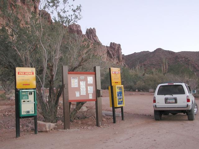 Pay Station |
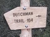 Dutchman Trail |
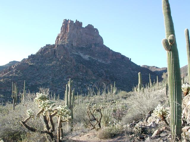
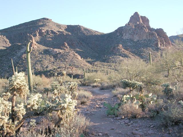 Miners Needle |
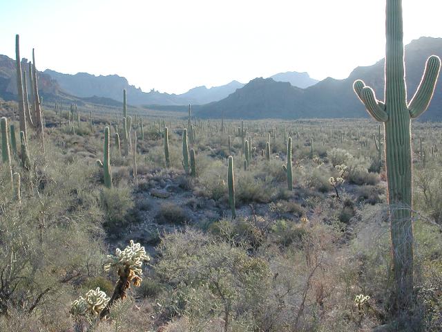
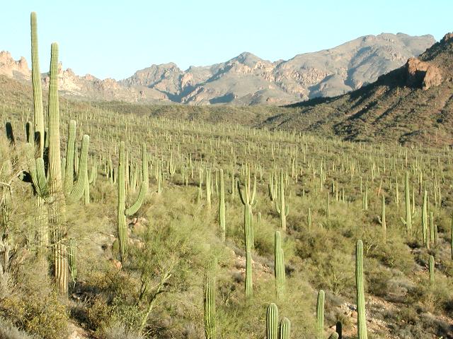
Barkley Basin is an excellent example of just how lush the Sonoran desert can be. It is filled with vegetation and is quite spectacular in the morning light. I walked along on level trails, serenaded by birdsong, and enjoyed the fine morning. After an hour I reached the junction with the Coffee Flat Trail at the base of Miners Needle. Cindy and I had been here together recently and the memory of our 9 mile loop around Miners Needle was still fresh in my mind. I turned left, staying on the Dutchman Trail and began the long, gradual climb to Miners Summit.
 Barkley Basin |
 Dead Soldier |
 Climb to Miners Summit |
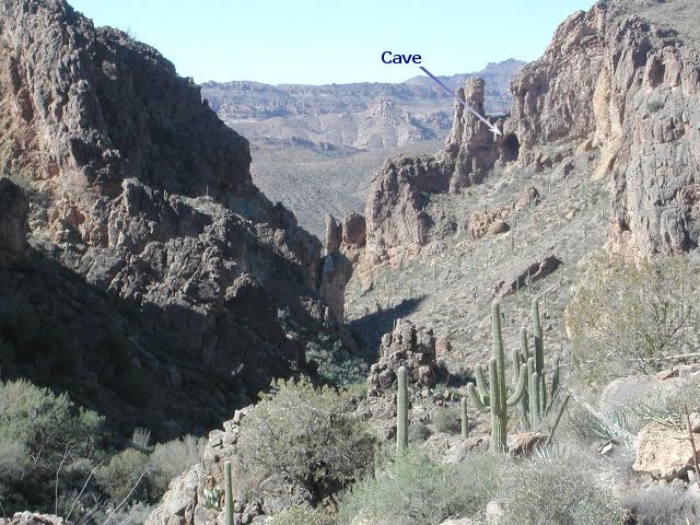
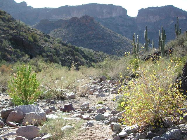
After nearly a mile of uphill, I topped out at Miners Summit, reached a trail junction and turned right onto the Whiskey Springs Trail. This trail soon descended into Whiskey Springs Canyon and followed a dry streambed. After a couple of miles, Whiskey Springs Canyon led to LaBarge Canyon where I found the junction with the Red Tanks Trail. LaBarge is one of the major drainages in the Superstitions and often has a voluminous flow of water during the spring months. However, Arizona had been unusually dry and LaBarge Creek was also dry at this time. I turned right and began making my way through Upper LaBarge Box, which is a rugged area of the canyon that is narrower than most. Along the way I passed by the notable cave, high on the northern wall of LaBarge Canyon. I considered climbing up to it, but chose not too. I had been up to it once before and found it to be not worth the effort. The cave itself doesn't go back in very far at all, perhaps 30', and has a sloping floor that is approximately the same grade as the canyon wall. There is no evidence that anyone ever used the cave for a home. Its floor is too sloping for a prehistoric homesite.
 LaBarge Creek |
 Lower LaBarge Box |
 Upper LaBarge Box |
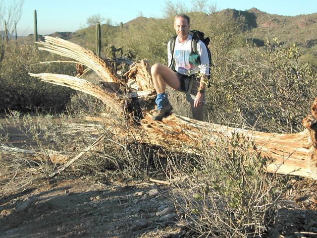
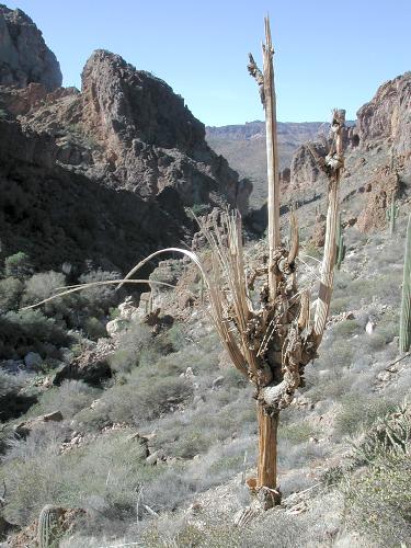 End of Life |
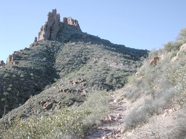
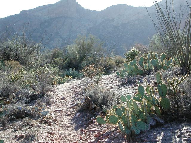
In an hour, I was though the Box and standing by the trail sign at the junction of the Red Tanks Trail and the Hoolie Bacon Trail. An odd name for a trail, the Hoolie Bacon was named after an old-time local rancher. I know no other details about the trail name other than that. I turned right, continuing on the Red Tanks Trail. After wandering around in lowlands, trying to keep sight of the sometimes elusive trail, I finally left the mishmash of streambeds and began climbing a grade toward the Red Tanks Divide. After topping out on the divide, I descended into Red Tanks Canyon on a long and meandering, mostly gentle grade. At 2:00pm, I reached the confluence of Red Tanks and Randolph Canyons and the location of the red tanks. Its not hard to imagine how Red Tanks got its name, as there is an abundance of red rock streambed in this area and usually water present.
 Red Tanks Divide |
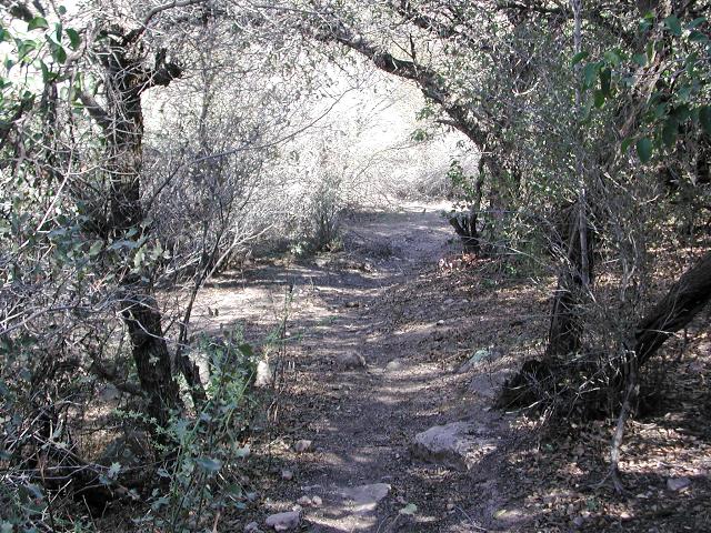 Shaded Trail |
 Red Tanks |
In wet years, water is flowing abundantly in this area and makes this idyllic location one of my favorites, not only for the opportunity to cool off on a hot day, but also for the magnificence of the scenery. On this day there was no flowing water, but there were many pools. I thought about jumping in for a dip, but the water was rather green and murky, plus it was surprisingly cold. I did splash around a little to cool off while pausing for a lengthy rest. The red tanks are fairly isolated and rarely visited, which adds to their desirability in my opinion. This day was no exception as no one else was around. I soon felt the need to move on, as I still had 7-8 miles in front of me and only 4 hours of daylight.
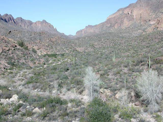
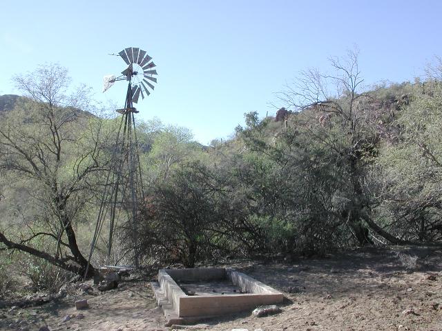
I picked my way south along the streambed to the confluence of Randolph and Frazer Canyons, only 0.7 miles away. Here, I picked up the Coffee Flat Trail and followed it east through Randolph Canyon, staying mostly in the streambed. In less than an hour, I reached the scenic location of Reeds Water. Reeds Water was named for Abe L. Reid (map makers misspelled his name) who prospected for silver from the 1930s until he died in 1957. His camp and mill were near the windmills, and his prospects were on the south slope of Coffee Flat Mountain. Both windmills are still present, although inoperative.
 Pools at Red Tanks |
 Randolph Canyon |
 Windmill at Reeds Water |
Now with mostly level walking on the Coffee Flat Trail, I left Reeds Water and began the 6 mile stroll back toward Peralta. Gentle grades and good trail brought me to a minor high ridge which separates Coffee Flat to the east from Barkley Basin to the west. Coffee Flat Divide, as I called it, is a fine stopping point to kick back for a few minutes and soak in the lush scenery. Miners Needle was close and after another 20 minutes of trail walking, I found myself back at the junction with the Dutchman Trail below Miners Needle. This effectively closed the loop and I now had only one hour of easy walking remaining. The sun was low and by the time I arrived back at my vehicle, which was 5 minutes before sunset. I marvelled at what an excellent day this had been and how I had walked for 10.5 hours, covered 21 miles of trail, and had not seen another soul the entire day. A pleasant day indeed.
 Coffee Flat Trail |
 Miners Needle again |
 Barkley Basin evening |