 Sierra Nevada Backpacking, 1993
The Sierra High Route, Cedar Grove to Dusy Basin
Click on any image to enlarge.
 Dave's 1993 Sierra trip was another solo, multi-day backpacking trip. The desire was to explore more of the Sierra backcountry, with the idea
of roaming several miles cross-country, without benefit of trail. The route for this trip was taken from the Sierra Club Totebook,
Dave's 1993 Sierra trip was another solo, multi-day backpacking trip. The desire was to explore more of the Sierra backcountry, with the idea
of roaming several miles cross-country, without benefit of trail. The route for this trip was taken from the Sierra Club Totebook,
In his informative guidebook, Roper details a high altitude route through the Sierras that roughly parallels the better known John Muir Trail. The Sierra
High Route offers several advantages over the JMT. The cross-country traveller experiences wilder, less-visited areas and encounters
fewer people, but the real charm of the route is that wherever possible, it sticks to higher elevations, mostly at treeline or above. The higher
altitudes offer arguably prettier scenery and also lessens some of the effort involved with climbing between low valleys and high mountain passes.
Roper's guidebook has since been reissued as
Needless to say, the High Route hiker must possess reasonable route-finding ability and must stay extremely aware of his or her location at all
time in order to stay on route. Travelling alone only increases the need for caution. Dave's account of the trip follows.
July, 1993
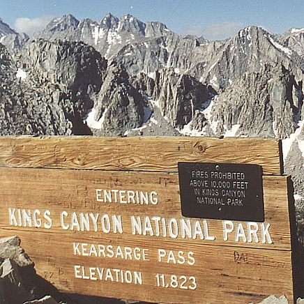 My High Route backpacking trip actually began at Onion Valley on the East side of the Sierras, near Independence, California. From there,
I would climb to and enter the vast Sierra backcountry over Kearsarge Pass, then continue East to the Cedar Grove roadend in
Kings Canyon National Park.
The High Route, per Roper's guidebook, begins at Cedar Grove. I would follow the High Route North to Dusy Basin, which is less than
halfway along the route. From there, I would exit over Bishop Pass to South Lake, near Bishop, California. My allotted time for this trip was
6 days to cover approximately 80 miles.
My High Route backpacking trip actually began at Onion Valley on the East side of the Sierras, near Independence, California. From there,
I would climb to and enter the vast Sierra backcountry over Kearsarge Pass, then continue East to the Cedar Grove roadend in
Kings Canyon National Park.
The High Route, per Roper's guidebook, begins at Cedar Grove. I would follow the High Route North to Dusy Basin, which is less than
halfway along the route. From there, I would exit over Bishop Pass to South Lake, near Bishop, California. My allotted time for this trip was
6 days to cover approximately 80 miles.
The climb to Kearsarge Pass is relatively easy when compared to other Eastside accesses, gaining 2800' over approximately 5 miles.
The pass provides a panoramic view into the Sierra backcountry and beckons the traveller to explore. Bullfrog Lake was just one of
many lakes that I visited.
A bear on my chest.
On my first night out, I awoke at 1:00am in a heart-wrenching panic, with the very real feeling that a bear was sitting on my chest in the dark,
inside my tent! I couldn't breathe! And I couldn't move. I placed my whistle in my mouth and tried to blow, but no sound came out.
I thought that I was a goner! Fortunately, I awoke and found it was only a dream, although a very realistic one. There was no bear, and I
had never touched my whistle. I had been asleep the whole time, but the feeling of panic was very real. Later I realized that the dream was
probably brought on by the effects of altitude. Normal breathing difficulties attributed to my first night at altitude (10,000'). I saw no bears
on the entire trip.
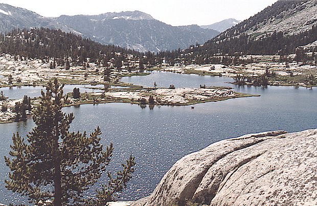
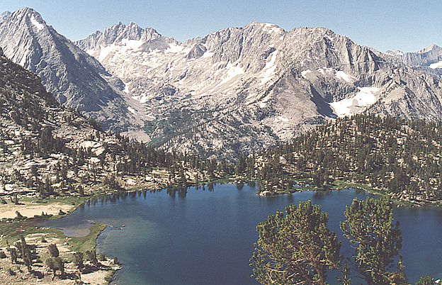 Bullfrog Lake lies West of Kearsarge Pass. |
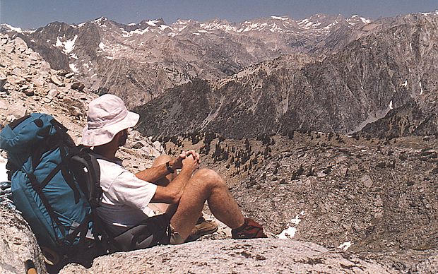 White Pass was one of twelve passes that I would climb to on the trip. |
A change of plans.
After nearly 15 miles walking along wooded Bubbs Creek, I arrived at the Cedar Grove roadend in Kings Canyon National Park. I was quite surprised
to learn that the Copper Creek trail, which I had planned to take North from the roadend, was closed due to a nearby forest fire. After consulting with
park rangers, I plotted an alternate course on the Lewis Creek trail, which also climbs North out of Kings Canyon, 8 miles West of the Copper Creek
trail. I would essentially parallel the Copper Creek trail and intersect the High Route on the following day near a place called States Lakes. While
attempting to hitchhike to the Lewis Creek trailhead, I was picked up by a ranger and scolded for hitchhiking in a National Park, where it is against
the rules. She did however, give me a ride to the trailhead.
After a laborious climb on the Lewis Creek trail, I made my second night's camp just below 10,000' Kennedy Pass. The next day, I spontaneously chose a shortcut that involved a few miles of unguided cross-country scrambling and did in fact then meet up with the Sierra High Route. I spent my third night at Horseshoe Lake, which was where I had hoped to be per my original plan. On Day Four, I began my first extensive off-trail journey in the Sierra backcountry, following Roper's guidebook. I encountered several high passes and many gorgeous lakes on my way to Lakes Basin, which was my home for my fourth night out.
 Lakes Basin was wild and pristine. |
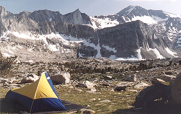 A lonely campsite in Lakes Basin, my fourth night out. |
Off-trail solitude.
 One of the joys of high altitude, off-trail travel in the Sierras is rambling through the sub-alpine meadows. With no distinctly defined
route to follow, one simply wanders through the surprisingly hospitable terrain at his or her leisure. When possible, the High Route does
as its name implies... it stays high. This represents a pleasant alternative to the long descents into the deeply wooded valleys that the
JMT and other trails visit.
One of the joys of high altitude, off-trail travel in the Sierras is rambling through the sub-alpine meadows. With no distinctly defined
route to follow, one simply wanders through the surprisingly hospitable terrain at his or her leisure. When possible, the High Route does
as its name implies... it stays high. This represents a pleasant alternative to the long descents into the deeply wooded valleys that the
JMT and other trails visit.
After spending an exquisite night in secluded Lakes Basin, I climbed a difficult Talus slope to sharply defined, 12,000' Frozen Lake Pass
and then headed East for a couple of miles to pick up the John Muir Trail, just south of Mather Pass. In some areas, the High Route
actually follows the JMT for a few miles before diverging in favor of staying high while the JMT may descend into a deep valley.
Click here to view photos of Frozen Lake Pass.
Back on trail, I followed the JMT North over Mather pass and walked alongside scenic Palisades Lakes before veering off-trail again to
stay high, just above the JMT's "Golden Staircase" which descends sharply into dramatic LeConte Canyon. My fifth and final night was
spent in a remote, secluded cirque which felt a thousand miles from civilization.
On my final day, I climbed two more passes before encountering trail again in Dusy Basin, just West of Bishop Pass. One last climb to 12,000' Bishop Pass, followed by five miles of downhill on the Bishop Pass trail, brought me to the exit at South Lake and the end of my trip.
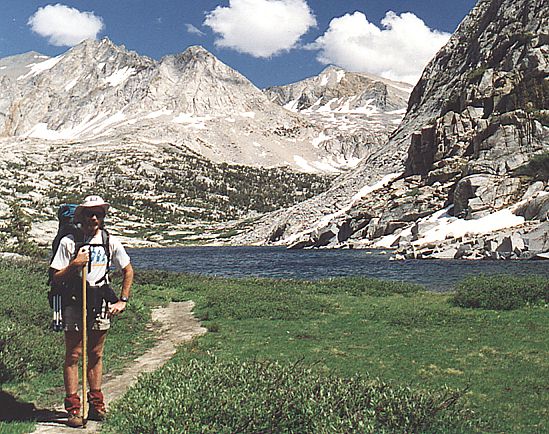 Trail near lower Palisades Lake. |
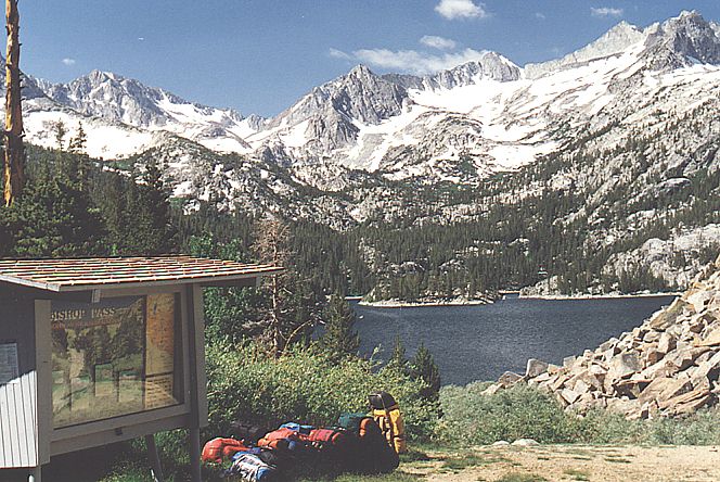 Exit trailhead at South Lake. |
Six days of backpacking in the less-visited areas of the Sierras presented me with newfound discoveries of remote and wild regions. I especially enjoyed the absence of other hikers for days at a time. The weather was perfect. The late-July wildflowers were abundant. The Sierra High Route definitely has a lot to offer and I hope to eventually return to continue the journey.