 |
Colorado River Spur Trail |
The Colorado River Spur Trail provides the easiest access to the Colorado River when descending into the Canyon via the Grandview Trail. Most maps do not show the Colorado River spur trail, in fact this little known route has appeared on only one old map of which we were aware. Most maps do not show it nor do they indicate any accessible route to the river in the vicinity of the Grandview Trail. Doug Minderlen, Greg Reinhart and myself (Dave Wyant) set off to find it.
Click on any image to enlarge.
September, 2001
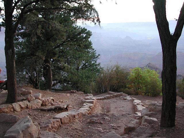
After spending the night in the nearby forest, we arrived at the Grandview trailhead a little before dawn. Due to the length of our planned dayhike (22 miles), an early 6:00am start was essential in order to make the most use of our available daylight hours.
 Greg, Dave, Doug |
 An early start |
 Dawn on the Grandview |
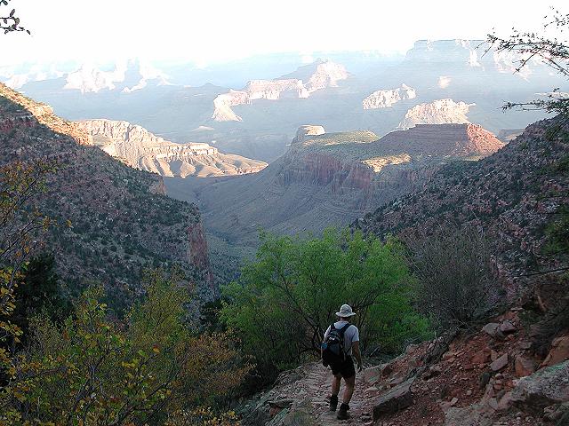
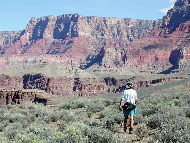
The Grandview Trail is considered an unmaintained trail, but it is in fine shape. Nevertheless, it is steep and rocky and as such, is actually more pleasant to climb than descend. As we descended into the Canyon, a faint odor of wood smoke and a slight haze gave evidence to three forest fires burning on the North Rim. After 90 minutes of picking our way down the Grandview, we arrived at lovely Horseshoe Mesa. We continued our descent, choosing the trail down the west side of the mesa to descend to Cottonwood Canyon and the Tonto Platform. After another hour, we arrived at the Tonto Trail junction and strolled west on the Tonto in the direction of Grapevine Canyon.
 Ruins on Horseshoe Mesa |
 West on the Tonto Trail |
 Cottonwood Canyon |
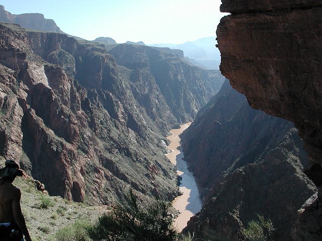
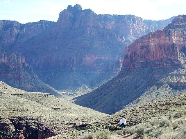
We walked the Tonto for an hour, peering into each arm of Cottonwood Canyon, looking for possible routes. Doug had attempted one cairned route the previous year, only to become cliffed out. On that trip, Doug was alone and not possessing technical gear nor the desire to use it, and had been turned back. From his experience, we knew which arm not to try. About halfway between Cottonwood and neighboring Grapevine Canyons, (see map) we found cairns indicating a more likely route that we predicted the spur trail might follow. Greg had earlier examined the map and chosen this spot as a possible location to descend to the river. See the map.
 Down the spur trail |
 The river below |
 Rough descent |
 Small beach at the river |
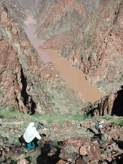
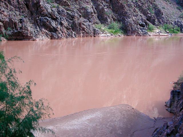
After a 50 minute, somewhat torturous 1200' descent on a route clearly marked with cairns, we arrived with tired legs and sore feet at the river's edge. The Colorado is sometimes brown and sometimes green, depending on the rate of release at upstream Glen Canyon dam. Today it was chocolate brown. Greg was the only one of the three of us that was brave enough to take a dip in the cold water.
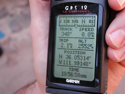 GPS coordinates at the river |
 Celebrating our arrival |
 Greg takes a cold dip |
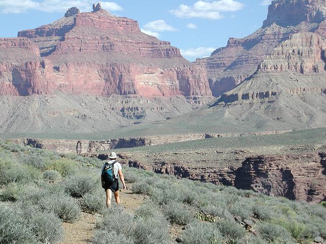
After such a rugged descent, we almost dreaded the climb back up to the Tonto, but although strenuous, the ascent was actually much easier on the feet, ankles and knees. After 45 minutes of climbing, we arrived once again to the Tonto trail and took a 30 minute break in the pleasant midday sunshine. Eight miles of walking along the Tonto trail awaited us. Each of us had previously walked many miles on the Tonto Trail and had come to love it. The next 8 miles would be gravy.
 Strolling the Tonto |
 Hance Canyon |
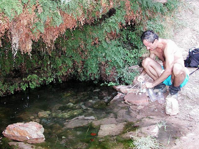 Page Spring |
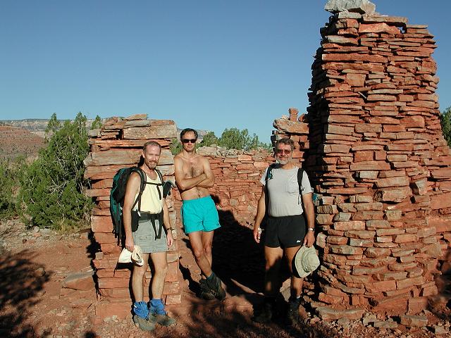
We walked around the base of Horseshoe Mesa, then followed Hance Canyon to its head and found the junction with the trail that would take us back up to the mesa. This trail passed by a rare, permanent water source at Page Spring, which is also known as Miners Spring on some maps. We filled up on water and continued our climb, passing by several old mine tailings and mining relics. The Last Chance mine lived a brief 17 year existence on Horseshoe Mesa from 1890 to 1907, when it was a producer of rich copper ore. The high cost of packing the ore to the rim and then shipping it to be refined eventually doomed the mine to failure. During a 10 year stretch of this period, Grandview became the Grand Canyon's most popular tourist area when Grand Canyon tourism was in its infancy. After the Santa Fe railroad reached Grand Canyon Village in 1901, few tourists opted for the jolting stage coach ride to Grandview. The Grandview Trail, built by Last Chance Miners to reach their mines, now serves thousands of hikers each year.
 Playing in an old wheelbarrow |
 Mining relics from the Last Chance Mine |
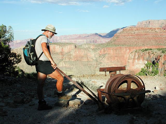 More mining relics on Horseshoe Mesa |
We left Horseshoe Mesa and started up the Grandview trail late in the day. The 90 degree temperatures that we had encountered earlier in the day had receded to a pleasant level that was comfortable for climbing. A steady effort brought us back to the rim shortly after dark. Along the way, we were treated to typically beautiful Canyon grandeur as the sun slowly set.
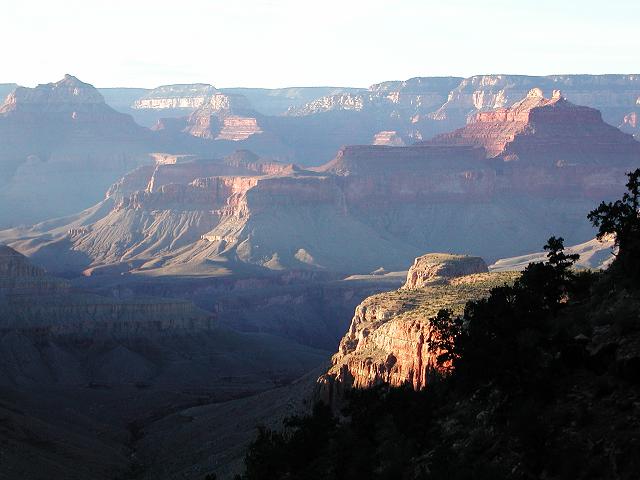 A typically Grand sunset |