 |
Superstition Ridgeline, 2003 |
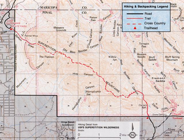
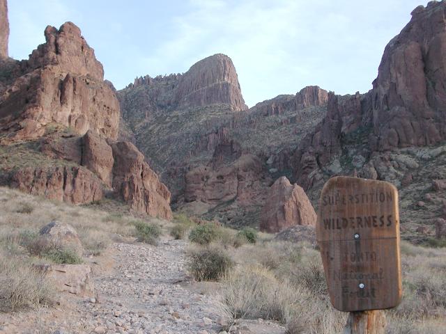
Lying in plain view from Apache Junction, massive Superstition Mountain beckons anyone with an adventurous spirit and a little imagination. This massive formation juts up so abruptly from the surrounding desert floor that it would be easy for the unknowing to believe that there could be no route to its summit. Yet appearances are sometimes deceptive and routes to the summit of Superstition Mountain do exist. On this December day, myself (Dave Wyant) and long-time hiking companion Doug Minderlen would tackle the ridgeline of the mountain, beginning at Carney Springs on the east side and ending at Lost Dutchman State Park on the west side. This route is well described in numerous places and often visited, but is far less travelled than most of the trails found on the wilderness map. Widely reputed to be a difficult hike over rough terrain, it was also highly acclaimed for its stupendous views. Doug and I had planned to explore the ridgeline for years, but had not done so until now. We were looking forward to the adventure.
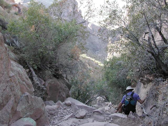
After leaving one vehicle at the end point in Lost Dutchman State Park, we drove around to Carney Springs which is accessed from Peralta road, approximately 1.5 miles south of Peralta Trailhead. Our day promised to be one of fine weather and pleasant temperatures, which is fairly normal for early December in the Sonoran Desert near Phoenix. Our 7am start was in early morning sun with a relatively balmy temperature of 55 degrees.
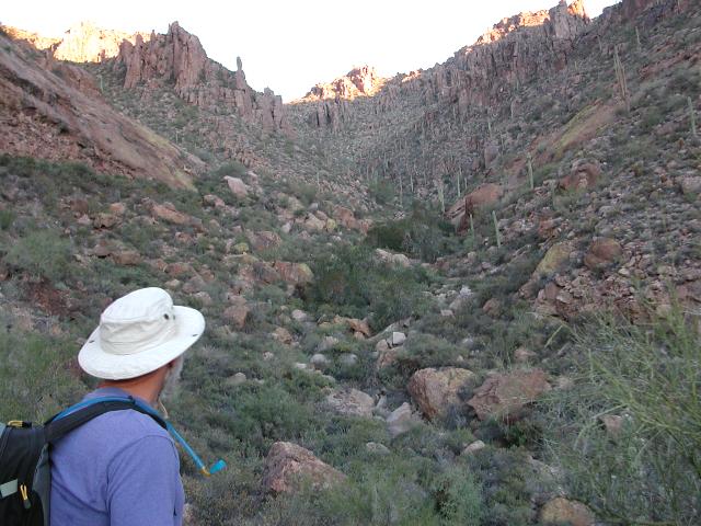
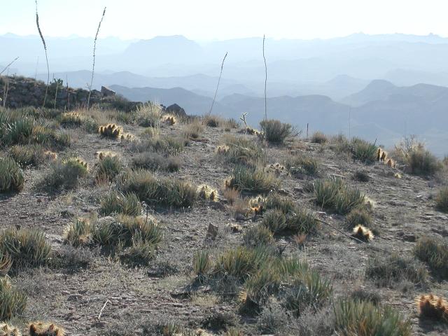
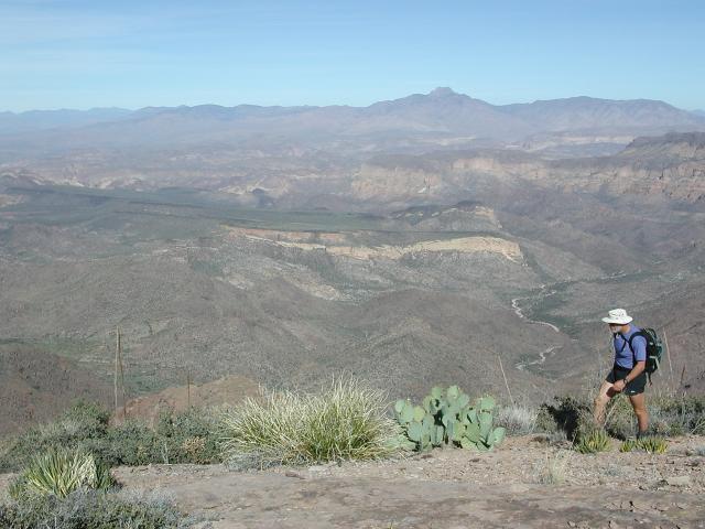
The hike started with a bang... a demanding 1400' climb from the desert floor to the significant landmark of West Boulder Saddle. Along the way, we passed by one expected false saddle that allowed us a few minutes to stop and catch our breath. Within an hour, we arrived at West Boulder Saddle and paused to soak in the view. West Boulder Canyon stretched out below us to the northwest -- in fact we were standing at the very upper reaches of this canyon. Due west, the Superstition ridgeline was in view, looking somewhat distant, but easily attainable. A faint, cairned trail led north, heading off in the direction of what would be the Dacite Super Loop. That would be an adventure for another day. We followed a more pronounced trail around the corner of a house-sized rock and headed toward the ridgeline. This trail wandered up and down a few rolling hills, then climbed steeply again to meet the ridgeline.
 The Climb |
 View, West Boulder Saddle |
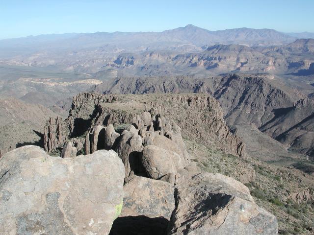
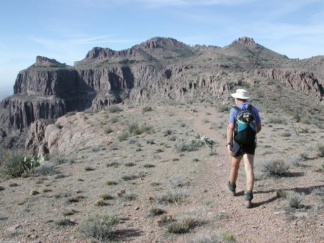
 Arrival at the ridgeline |
Upon reaching the ridgeline, we were treated not only to the outstanding views of the Superstition backcountry that we had enjoyed for the previous half hour, but also to expansive views to the desert floor and the civilized areas to the south. We were obviously on the ridgeline and would follow it for most of the remainder of the day. Not knowing exactly what to expect, we were pleased to have a distinct trail to this point. In fact, we would find that the entire route from end to end is easy to follow if one keeps their eyes peeled. In the few places where the trail is difficult to follow, cairns mark the way. Although basic route-finding skills are required, the trail is not excessively tricky and getting lost is unlikely.
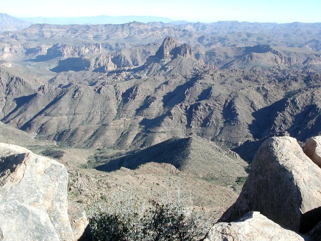
 Ridgeline views |
 View east along the ridge |
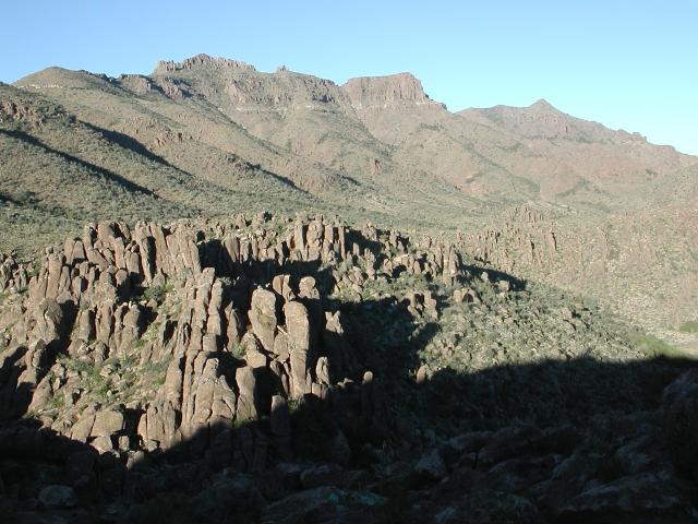
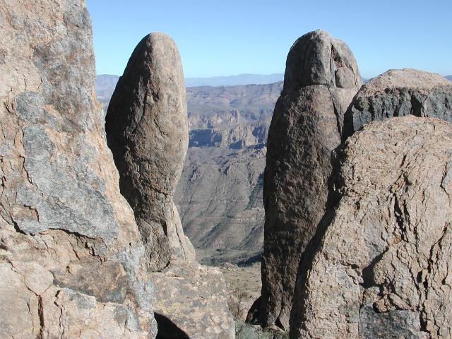 Hoodoos |
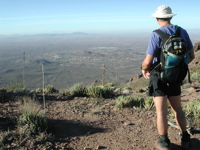
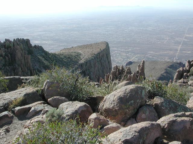
Our next immediate goal was the high point on Superstition Mountain, sometimes called South Summit by those who write about such things. We knew it only as Peak 5057 on the map, the high point on Superstition Mountain. We strolled along the ridge heading generally west until we came to the base of the rocky protrusion of Peak 5057. "Strolling" does not accurately describe our travel, as there are not many places along the ridgeline where walking is so easy. Mostly the trail is either up and down or involves some kind of negotiation of rough trail. At the base of Peak 5057, we veered off of the ridgeline trail on a side trail that appeared to lead to the summit. After a few minutes of additional climbing, even scrambling in a few places, we topped out on Peak 5057, aka South Summit, the high point on Superstition Mountain. The views were every bit as stupendous as we had imagined them to be.
 Superstition Mt. summit |
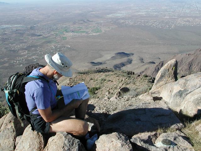
 Summit views |
 Summit views |
After lounging on top of this magnificent peak for a half hour, we retraced our steps back down the rocky slope and picked up the main trail again. We were only a quarter of the way along the ridgeline and still had some distance yet to travel. We had read about the reported difficulty of this trip and were mildly concerned about having enough daylight, being that we were doing this at a time of year when the days are shortest. Nevertheless, we continued on our journey at a fairly relaxed pace since there were still 6-7 hours of daylight remaining. We had read enough descriptions of other trips, said to be excruciatingly long, hard, or difficult, to know that these reports are to be taken with a grain of salt. Typically the difficulty is overstated. Besides, most of the trip reports of the Superstition ridgeline indicated that the average time required for this hike was around 10 hours. Given that we had started around 7am, we had approximately 11 hours of travel time before darkness would fall. We would be able to finish the trip in daylight, but had flashlights with us just in case.
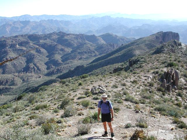
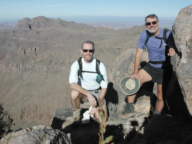 Dave and Doug |
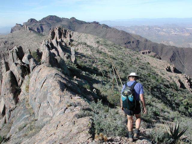 West along the ridge |
 A stroll with a view |
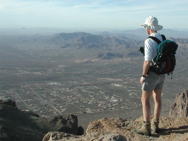
The ridgeline trail continued on its westward course, offering delightful, birds-eye views all along the way. Although the route typically involved only minor elevation gains and losses, this was a secondary trail that became tiring as the miles passed by. After a few hours, we approached the west end of the ridge and made the decision to veer from the trail in order to climb the second highest peak on Superstition Mountain. Sometimes referred to as West Peak, this summit at 5024' is only slightly lower than the high point of South Summit, elevation 5057'. We could find no cairned route leading to West Peak from this east side, so we opted to just "go for it" and make a beeline for the summit. This proved to be a rather tiring endeavor, but we soon found ourselves standing at the summit, enjoying the magnificent views.
 Nearing the west end |
 View back |
 View from West Peak |
We carefully picked our way down the western side of West Peak following a route marked with cairns and spray paint, then ambled out to the edge of the prominent monolith of the Flat Iron. We were familiar with the Flat Iron, having been there several times on previous trips. In those earlier years, we had marvelled at the Flat Iron and its awesome views, but today the views seemed almost a letdown compared to those that we had been engulfed in all day long on the ridgeline.
We were on "home stretch" now, having only to descend through Siphon Draw to get to our vehicle parked at Lost Dutchman State Park, 3 miles away and 2700 vertical feet below. We knew from past experience that a descent through Siphon Draw is no picnic, and this proved to be true today. The first trick is to find the descent point from the edge, since the route down into Siphon Draw seems implausible unless one knows differently. We knew the descent point and found it quickly, but for a traveler who was unfamiliar with its location, especially if finishing a trip in the dark, finding the route down would be difficult.. With careful and deliberate footing, we safely descended the steep draw and eventually found ourselves back at our vehicle and the end of the trip. It had been a spectacular day and probably the most scenic Superstition trek that we had been on.
 On the Flat Iron |
 Upper Siphon Draw |
 Siphon Draw |